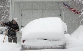
 You can call it the blizzard that almost was.
Throughout last week, the computer models were cranking out yet one of the those solutions that make most people cringe this time of year. That solution was another major east coast snowstorm that would have affected parts of the great lakes including Ohio, Pennsylvania and West Virginia.
As most of these storms have done, this one deviated from its projected path. Unlike the last one that went too far west to produce widespread snow, this storm shifted to the east sparing the aforementioned states but not New England. The storm might not have been of the magnitude of the March 1993 storm that is now ranked as the worst snow storm of ALL-TIME but it produced more snow for places like New York City than any storm in RECORDED HISTORY! Try 27 inches in 24 hours.
 All that areas of Cleveland saw from the storm was a few fluffy inches (up to 5 in spots) that quickly melted or blew away.
Here is a view from outside shortly after the snow ended. Notice the blue sky and hardly any significant accumulation.
Another major meteorological bullet has been dodged. Now if Lake Erie would just freeze over.
No comments:
Post a Comment
Note: Only a member of this blog may post a comment.