 |
| Courtesy: Cleveland Public Safety |
First, some clarification on winter watch/warning definitions: A WINTER STORM WATCH means there may be hazardous winter weather due to heavy snow. Heavy snow means 7 INCHES OR MORE of accumulation in 24 hours or less. They are issued at least 12 hours before the hazardous winter weather is expected to begin. When the storm becomes imminent (inside 12 hours of occurring) or has a high probability of occurring, watches are upgraded to a "WARNING" which was done yesterday for select counties.
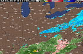
Leading edge of the snow is pushing into southern Ohio. CLICK ON THE IMAGE BELOW FOR THE CURRENT RADAR OVER OHIO
The timing of the snow looks like this: SNOW IN AKRON/CANTON/NEW PHILLY BY 2PM, CLEVELAND BY 3PM. AFTER THAT, THE SNOW SLIDES WEST.
Accumulations from TUESDAY LATE AFTERNOON through WEDNESDAY LATE AFTERNOON look like this. Most of this will fall this evening and tonight:
Hazardous travel through western PA and western NY state. The major airports along the east coast will only see rain from this system. Any flight delays will trickle down from the inland airports like Hopkins in Cleveland, Pittsburgh, Buffalo and Rochester.


No comments:
Post a Comment
Note: Only a member of this blog may post a comment.