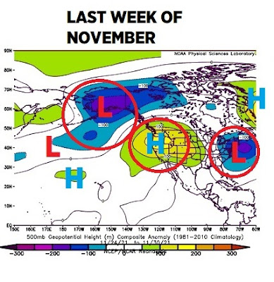
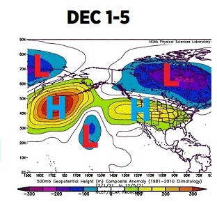
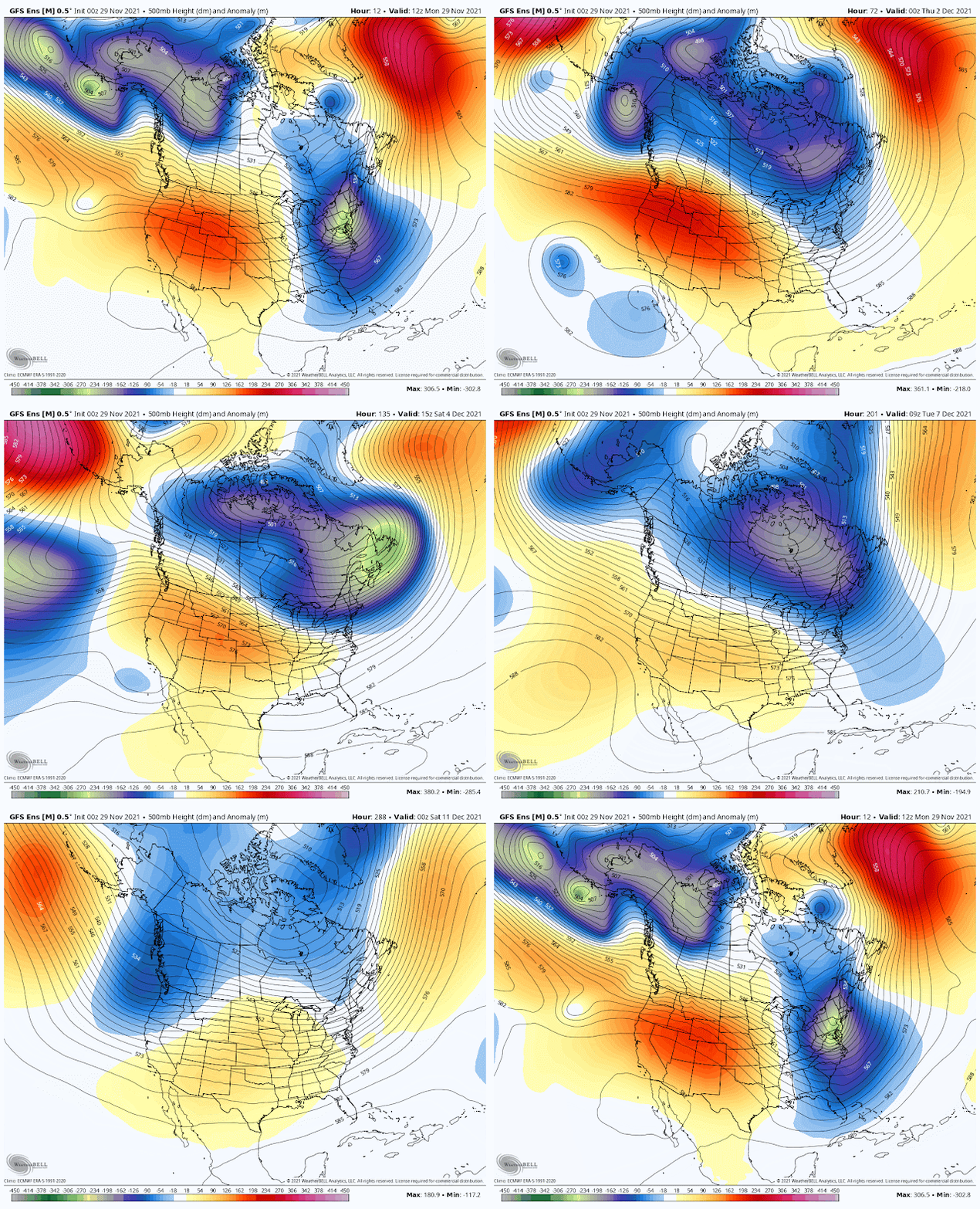
Check out the upper level pattern in November. The red areas are high pressure. Blue areas low pressure. Notice how progressive the storms systems were. Temperatures were colder than normal. No definitive regions of high pressure (blocks) locking in a long stretch of cold or warm.
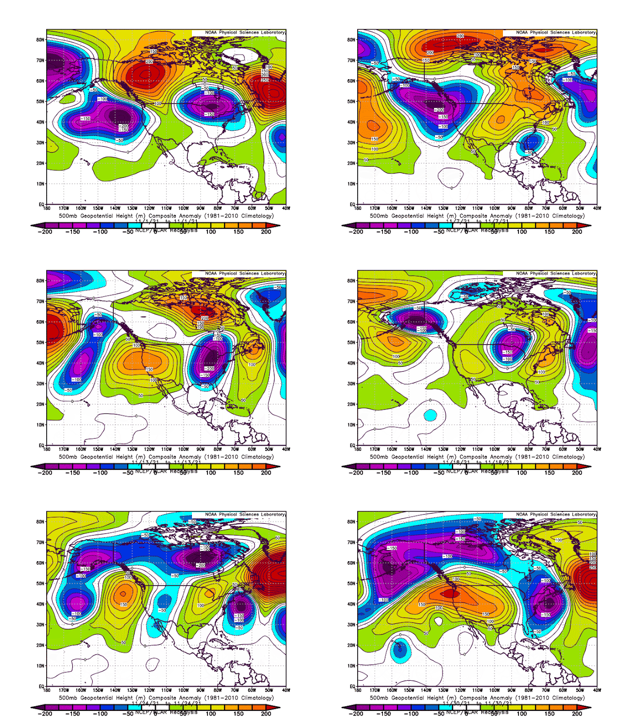
The last week of November showed no Pacific ridge locking this pattern into place. Look at the low over Alaska and the low off the east coast.
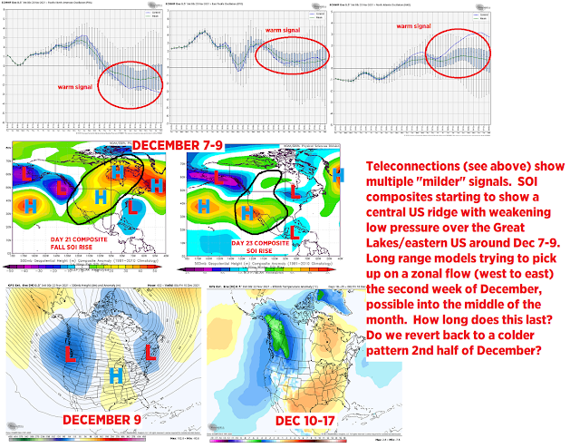
Around that time, the Pacific was giving us signals of warmth for December. Here is the long range outlook I published on November 23rd
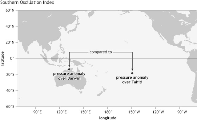
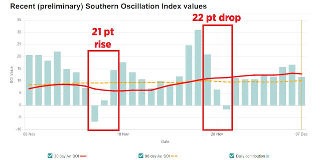
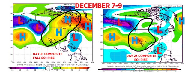
The SOI (southern oscillation index) was signaling, around the same time, the same warmth with brief cooler interruptions.
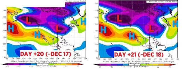
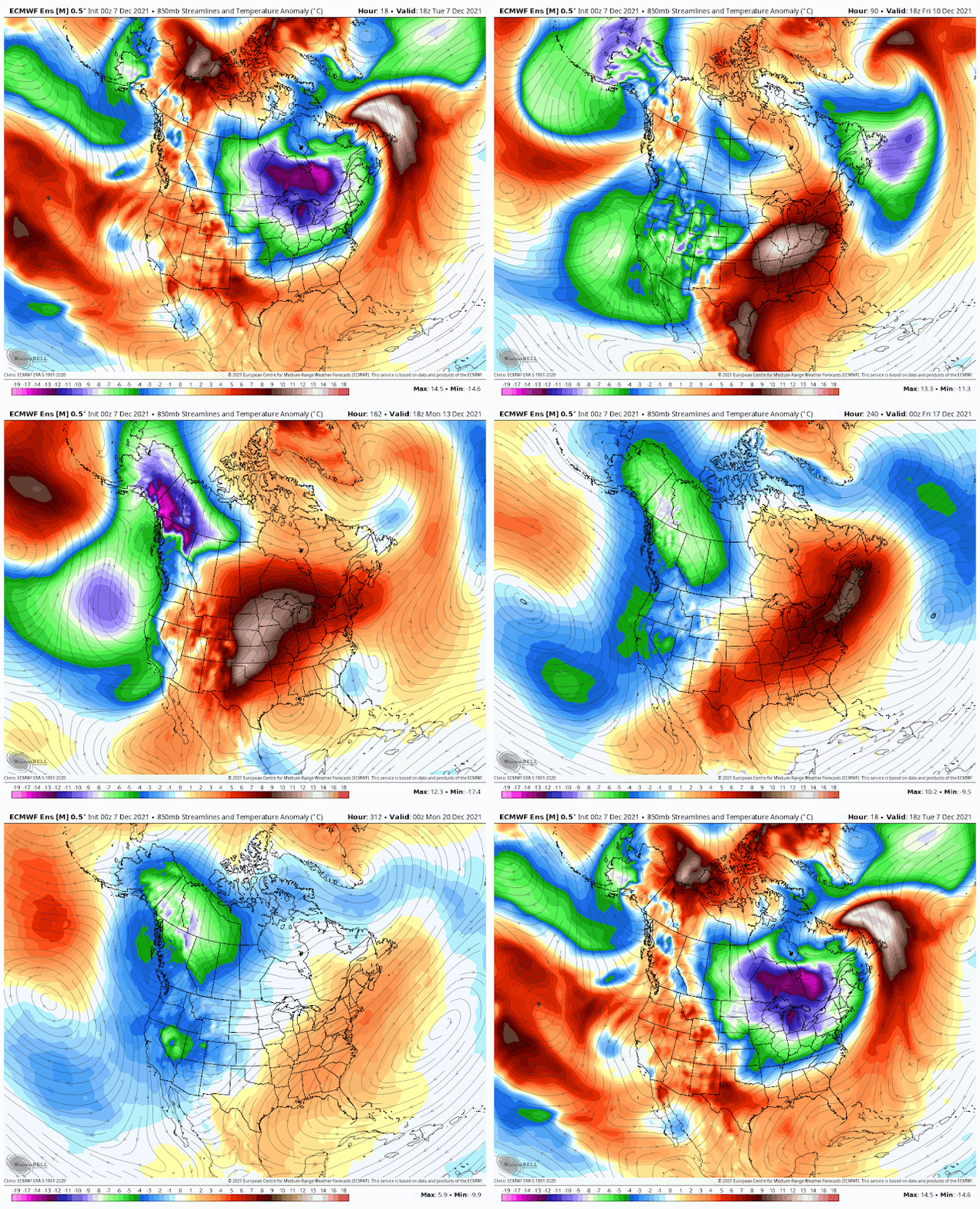
The actual upper level pattern started to change in early December. Western Pacific ridge was popping. All of this develops in a response to the La Nina background state. BLUE REGION in the middle
By the second week of December, the low retreated into Canada. The Pacific ridge and east coast ridge was building.
 |
| DECEMBER 6-10 |
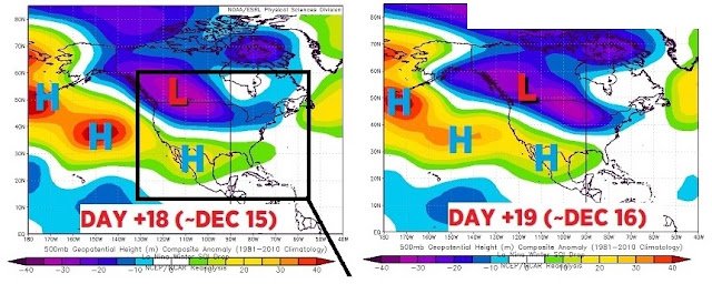
By the middle of December, two separate high pressure ridges developed. The main ridge over the northern Pacific. The other over the eastern US with a western trough.
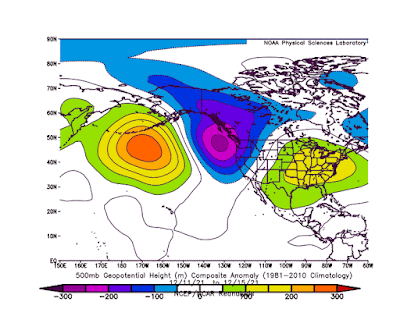 |
| DECEMBER 11-15 |
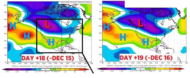
The third week of December featured the strengthening Pacific ridge as the eastern US ridge shifted south.
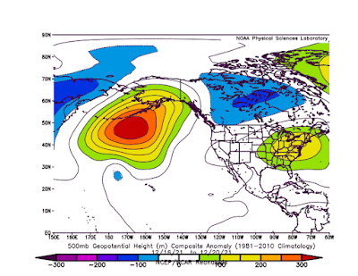 |
| DECEMBER 16-20 |
December as a whole shows each ridge dominating the pattern.
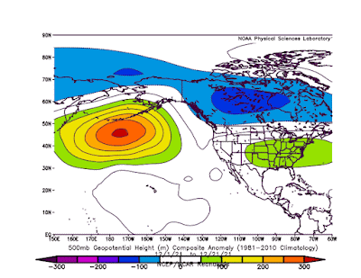 |
| DECEMBER 1-20 |
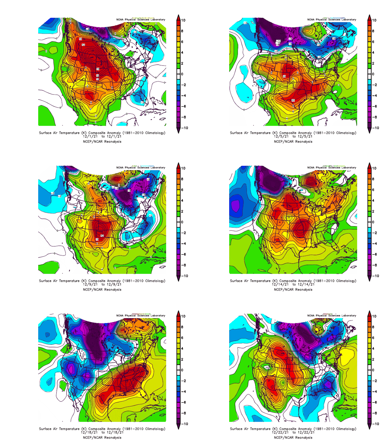
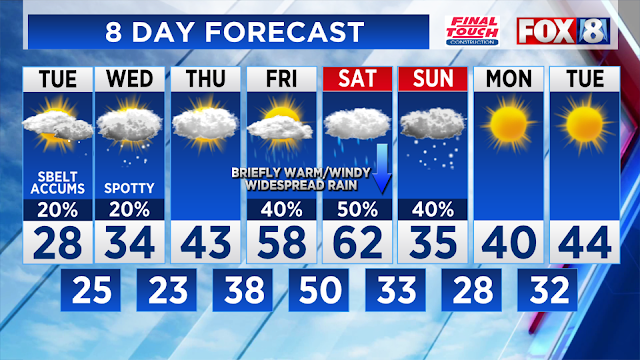
Look how the daily temperatures progressive throughout the month. A few brief colder intrusions but nothing sustainable.
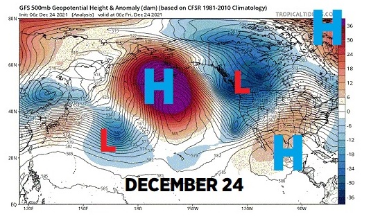
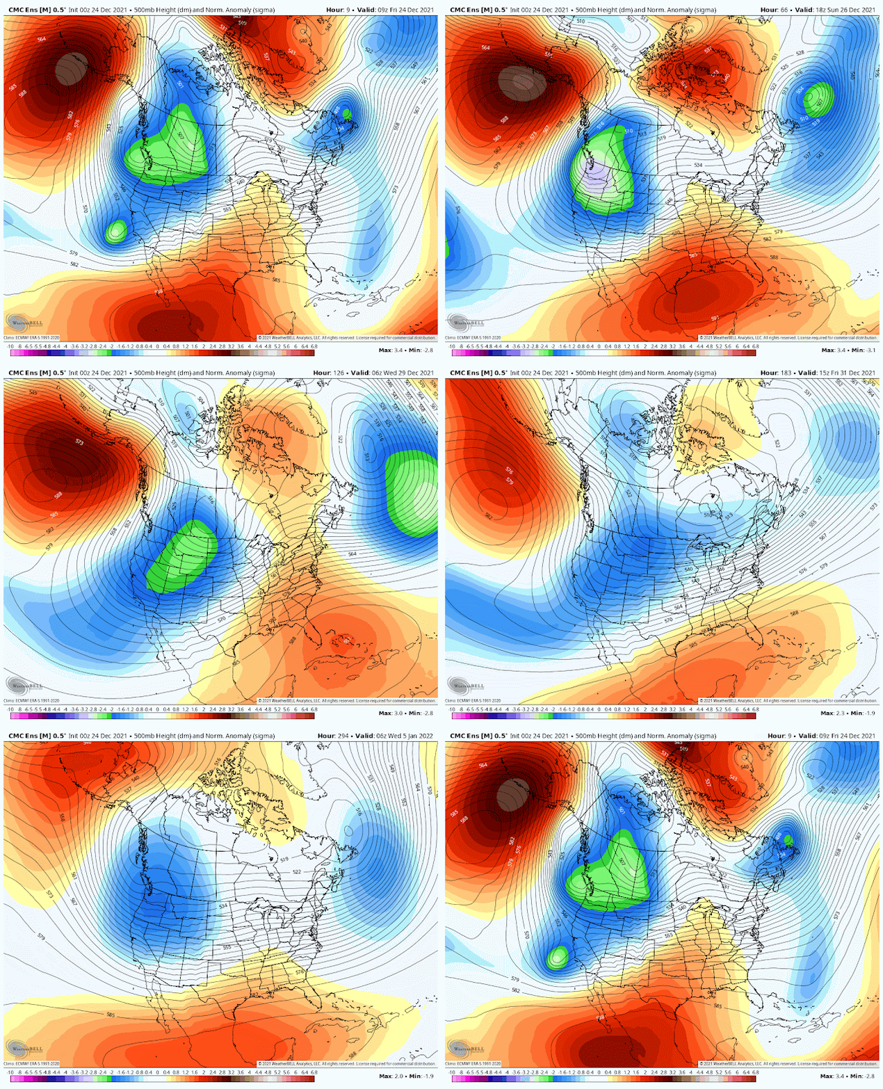
As of this writing on Christmas Eve, the pattern still shows the HUGE Pacific ridge not budging as the SE ridge settles in.
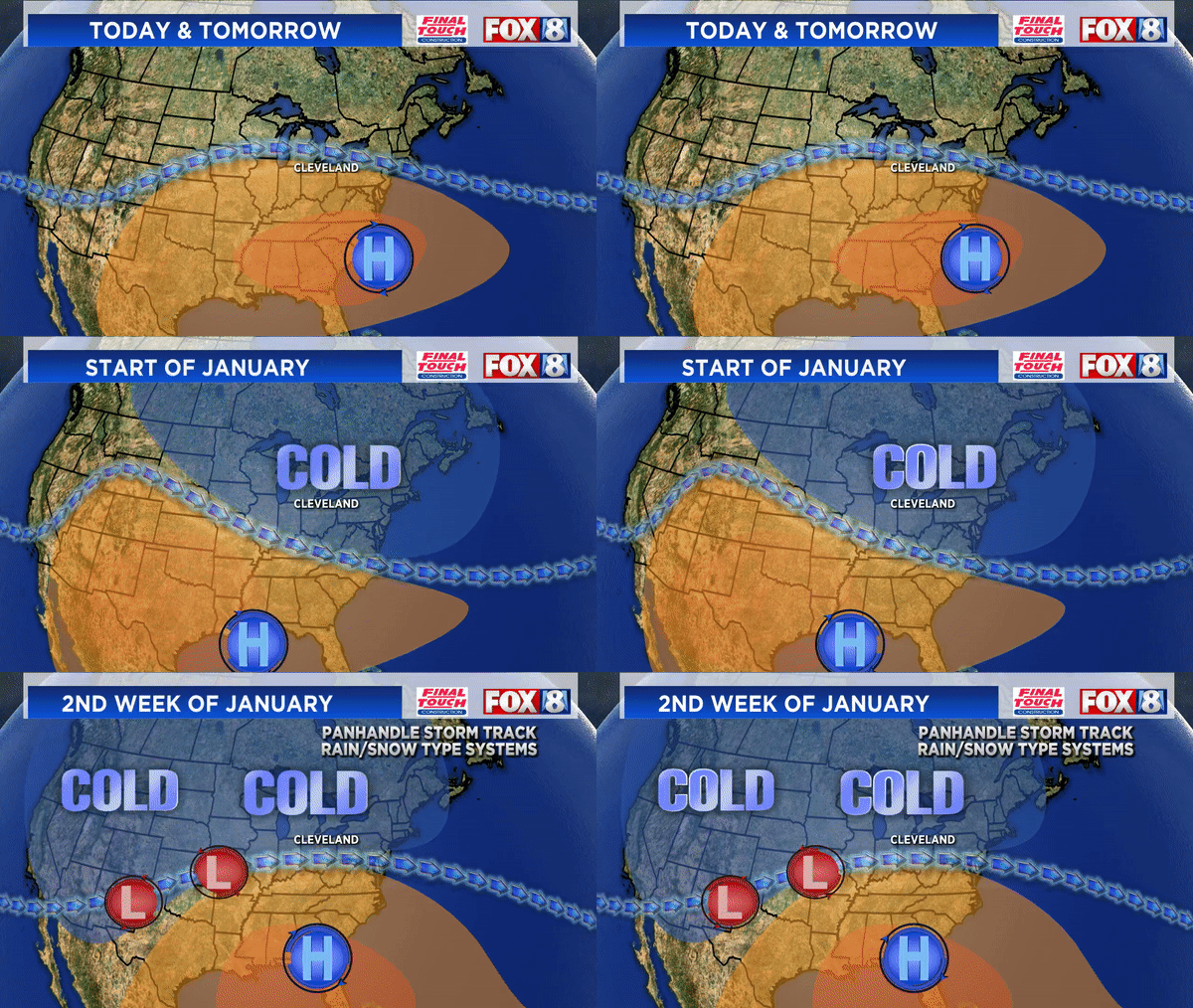
What does this mean overall? Milder temps continue through the remainder of the month. Models show the SE ridge weakening a bit as we head into January.
Overall our confidence in increasing for a dominant panhandle storm track in January. This would feature rain/snow mix type systems from Oklahoma then northeast into the Ohio Valley.
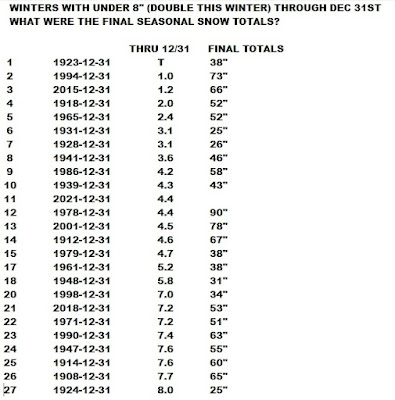
December 2021 has only a trace of snow! Only two other Decembers have had just a trace of snow. 1931 and 1923. Just for fun, what was the final winter snowfall after snow totals under 8" through the end of December?