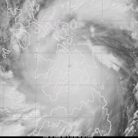
Super Typhoon Haiyan made landfall over the Philippines Thursday afternoon Eastern Standard Time with winds reported at 195 mph. Keep in mind that in the western Pacific, unlike the Atlantic where Hurricane Hunters fly into hurricanes to take wind and pressure measurements, no flights are made into these tropical systems. So wind speeds are estimated with satellite data. Some verification of the 195 mph speed will need to be done before the experts can say with certainty that this is legit.
A great visible satellite image and loop showing the well defined eye as it passed
Now the loop. Click on the image below
Watch the feeder bands weaken through this microwave imagery satellite loop as it passes over land then reorganize once over open water
A really neat image from Eurosat with the curvature of the earth as a reference point. The diameter of Typhoon Haiyan is roughly 400 miles. Hurricane Katrina's diameter was similar.
What are the tropical storms that had wind speeds of 190 mph?
Typhoon Tip in 1979 hit 190 mph at peak intensity in the western Pacific
Hurricane Camille in 1969 had wind speeds of 190 mph when it hit the Gulf Coast
For comparison sake, Hurricane Katrina had wind speeds of 120mp when it hit Louisiana in 2005
According to Dr Jeff Masters of the Weather Underground, typhoon wind speed estimates were too high in the 1940s through the 1960s. He has a list of typhoon wind speeds from that period that are a bit suspect HERE.
The track of Typhoon Haiyan is west over the South China Sea and into Vietnam Sunday.


No comments:
Post a Comment
Note: Only a member of this blog may post a comment.