Saturday, January 31, 2015

Superbowl Sunday 8:30PM Update: Road Conditions Worsening

ROAD CONDITIONS ARE WORSE NOW AND WILL CONTINUE TO WORSEN OVER THE NEXT SEVERAL HOURS

* Temperatures have climbed into the lower 30s which caused the snow to transition to sleet then back to snow in many areas especially across southern areas.

* Look at the Ohio valley radar below. The snow shield extends back to Iowa.  As mentioned on Friday and reiterated yesterday and again this morning, this will be a long protracted snow events through early Monday.

* The wind field shown below shows the wind shift in Illinois from the northwest along with colder temperatures. CLICK HERE FOR THE MOST RECENT WIND MAP


Some breaks in the snow before the second more potent area of wet snow moves in around Superbowl Time.  Temperatures will start to fall after midnight into the 15-20 degree range with wind chills between zero and -5 by Monday morning.


SNOWFALL FORECAST IS ON THE BOTTOM OF THIS POST 

Current radar loops are below.


Central Great Lakes sector loop


I LIKE THE NWS STORM TOTALS (BY MIDDAY MONDAY)


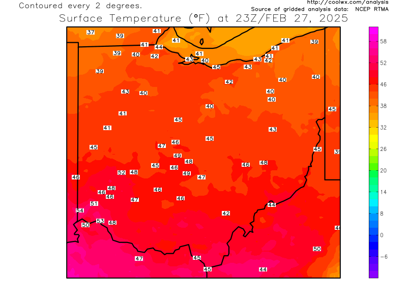
Current OHIO temperatures HERE

PAST FORECAST GRAPHICS ARE BELOW...


YOU CAN SEE THE CHANGES COMPARING IT TO THE SATURDAY FORECAST
YESTERDAY'S SNOW FORECAST LATE SATURDAY


Friday, January 30, 2015

SATURDAY UPDATE: Significant Snow for Ohio Late Superbowl Sunday

Earlier this week after the Blizzard of 2015 shifted to the east focusing the major snow away from New York City, many meteorologists took to Twitter talking about how too much forecast uncertainty in message breeds inaction. I agree. This is why you will never see me post a snowfall forecast for a potential snow event more than 3 days out.  I might broad-brush the overall setup with generalities but an official snowfall forecast won't happen until we are inside 48 hours. The public wants a concrete forecast. Their risk is personal.  In order to give the best possible snowfall forecast with the least amount of uncertainty, I wait...

This takes us to the Sunday-Monday event.  I posted on Facebook how the the model projections are all over the place. I won't post that image here.  You can see it on my FANPAGE if you are inclined.

This snow system is far different in that it will encompass a huge geographic area with tons of moisture. The duration of snow over northern Ohio will be at least 9-12 hours maybe more.

Anticipate school delays and closing Monday.

SNOWFALL FORECAST IS ON THE BOTTOM OF THIS POST 

Current radar loops are below.

Central Great Lakes sector loop


The track is a bit farther north. Here is the snow forecast from the onset of the snow through late morning Monday. The heaviest snow will be from mid afternoon Sunday through midnight.


Wednesday, January 28, 2015

Post New England Blizzard Thoughts

I will admit that I bounced back and forth on a final NYC snowfall forecast late Sunday/early Monday as the new data was coming in showing the nor'easter farther east.  In the end, the storm developed farther east.  I reluctantly went with higher amounts for NJ and NYC. It didn't pan out although Long Island got hit hard. Was it a bust? Hardly. Were the amounts way off for many locations? Absolutely.  Were the amounts accurate for other locations? Yes.


Should snowfall forecasts have been altered?  Probably.  Then again, when you warn 50+ million people, it's very hard to retract a Blizzard Warning that stretches along hundreds of miles of coast line. You live by the sword and die by the sword in the court of public opinion (now social media).

I participated in several twitter discussion with other meteorologists and broadcasters about what we as meteorologists/broadcasters still need to do better in communicating the essential aspects of extreme storms.  The responses were very enlightening.  I know I will take all of this and apply it to my own weather world here in northern Ohio in future weather events. 

Here are several key points, questions and comments from these Twitter conversations. I paraphrased some the statements:

* I have a very difficult time (as a meteorologist) blaming people for focusing on their situation in their town.

*  The science of Meteorology & forecasting are getting so much better but our communication of that information is getting worse & worse IMO.

*   Lets not forget this was like the 1st hurricane of the season, it always gets out of control coverage. No one covers storm ten like storm one.

*   This storm is an excellent case where choice of words in conveying severity is of the utmost importance.

*   People just hear the big numbers and worry just about that!

*   Risk is personal. Mass media is for the masses. Have to find the middle.

*   (response) Here lies the conundrum: Risk is personal. Yet people want personal forecasts


*  Too much emphasis on uncertainty can breed inaction.


*  We need a delicate balance between voicing uncertainty and a declarative forecast for general public

*  "Our NYC forecast, while hardly perfect, was useful"

*  Why no uncertainty cones with these types of systems ?

*   Public can't grasp reality outside of our own weather window

*   Yes but there is so much message competition now and some/a lot operate outside of the Weather/EMA/Gov enterprise...message competition plays a huge role, I think. Even decision makers who we work closely with fall victim to confusion.

*  Some in my business (media) don't care about public good, credibility or long term gain. They get judged on clicks, shares, ratings

*  "There is more risk and nuance in weather forecasts than the public is interested in consuming so it is a challenge to craft a message that gets attention, is not "hype", yet has actionable information.'

If you have anything else to add, let me know.  Comments below.

Sunday, January 25, 2015

Major Snow/Blizzard Conditions For New York, Boston Expected


East coast storm continues to develop in Ohio Valley. Current Ohio Valley radar loop

Central Great Lakes sector loop

Northeast radar composite

Central Great Lakes sector loop

Winter Storm Warnings and Blizzard Warnings are in effect for New York City, Boston and all east coast areas from southern New Jersey to Maine.

The classification of a blizzard has nothing to do snowfall. It has everything to do with WIND and VISIBILITY.

BLIZZARD DEFINITION:

* Sustained wind or frequent gusts to 35 mph or greater for a period of 3 hours or longer
* Falling or blowing snow reducing visibility to less than 1/4 mile.

The exact words from the NWS Office in New York City:


See how the Clipper Snow moving through Ohio and Pennsylvania "bombs" into this major Nor'Easter.

Late Monday surface map
Tuesday Midday
New York City Snowfall forecast per the NWS - LINK HERE


Boston Snowfall Forecast - LINK HERE


New Jersey snowfall forecast - LINK HERE


Friday, January 23, 2015

Widespread Snow Sunday

Abnormaly strong clipper system moves across northern Ohio Sunday. Here are the real-time radar loops showing the snow moving in.


Current OHIO temperatures


Current Ohio Valley radar loop

Central Great Lakes sector loop


Initial, broad-brush snowfall forecast. NUMBERS WILL NEED TO BE ADJUSTED AS WE GET CLOSER TO THE SNOW EVENT! 

New computer projections are shifting the heavier snow across southern counties...more later

Thursday, January 15, 2015

My 15 Favorite Movies of 2014 (in alphabetical order)


OSCAR NOMINATIONS SITE

Begin Again
Birdman
Blue Ruin
Calvary
Chef
Grand Budapest  Hotel
Guardians of the Galaxy
Ida
Interstellar
Lego Movie
Locke
Predestination
Snowpiercer
Theory of Everything
Whiplash

Wednesday, January 14, 2015

Arctic Overnight Lows Wednesday Morning

Lake Erie ice from 3 miles offshore
Three ingredients promote huge temperature drops in winter: Clear skies, calm winds and snow cover. We had all three Wednesday morning.  Here are the official web weather spy reports on our blog!

Temperatures as of 8am:


Coldest region was as area between Lorain, New London and Medina.


I was originally cautions on this temperature reading of -18 reported from the Kipton, Ohio automated station in southern Lorain county. Given the other temperatures surrounding it, it's definitely possible.

Here are some reports/temperature photos from viewers.

Elyria

Grafton, Twsp

Huron

Portage Lakes

Plymouth

Rome

Sandusky

Bath


Saturday, January 03, 2015

Current Radar Loops - Freezing Rain, Steady Rain, Arctic Air

Spotty freezing (rain that hits the ground and freezes on untreated surfaces) will be mixed in with general rain this morning. The transition to all rain will continue by late morning as temperatures climb into the upper 30s, lower 40s by mid afternoon.

Rainfall amounts will be significant. See graphic below.


Current OHIO temperatures


Current Ohio Valley radar loop
Central Great Lakes sector loop


Temps will climb into the 50s tonight and early Sunday then drop by late afternoon.


Arctic air returns next week with lake effect on Monday, General "Clipper Snow" Tuesday for all of northern Ohio (several inches very possible) then more lake effect Wednesday and early Thursday. Its not only Cleveland and northern Ohio. Much of the eastern 2/3rds of the US will experience temperatures similar to last January.


Lake Erie water temperature is 37. Typically we need an approximately 23 degree temperature difference (Fahrenheit scale) between the lake water and the air aloft (5000 foot level) for lake effect to develop. That puts the threshold at 14 degrees Fahrenheit at 5000 feet. By Wednesday of next week, the temperature will drop to -9!  Again, this is all in Fahrenheit.  (-22 to -25 for meteorological purposes in northern Ohio). For comparison, the "Polar Vortex" event last January had a 5000 foot temperature (850 mB) of -23.

Daytime highs might stay in the single digits Thursday according to one projection.


I hesitate to give snowfall projections this far out. But considering that the extended models have been very consistent with this arctic air or late (some too warm; some too far west with the cold), posting a preliminary snow forecast seem reasonable. TUESDAY'S CLIPPER could drop between 2-4"+ across northern Ohio.

By the end of next week, significant snow cover will blanket much of the snowbelt.  Get ready.  Winter is back!