Thursday, December 24, 2015

My Hand Drawn Christmas Cards


Wednesday, December 23, 2015

Let's Clear Up A Few Things...

Many wonder why I write so much about the psychology of weather. If you read the comments on most of my posts over the last several weeks you'll see why: They believe what they want to believe. They use social media as a conduit to say whatever impulsive thought they want without recourse. Perception is the ultimate reality.

I use social media and my blog to show why weather events occur the way they do. I post stats and records about past weather to show some perspective in the hope that this will help viewers of our station and the general reader. Often times it just doesn't work...much to my dismay.

So let's clear up a few things. Rather than use science to explain the why we do what we do, I'm using straight forward bullet points. Let's wipe the slate clean and start out fresh and new as we approach the end of the year.

*******************

1) It WILL snow at some point. It always does. And no, I don't like snow.

2) The warm weather is playing with our minds.  Our weather perceptions (cognitive biases if you will) are very strong.  We are not immune.  We are all human.  Recognition of these preconceived notions is the first step in an objective understanding the weather and the science that governs it.

2a)  We hate forecast uncertainty. Here's why LINK

3) Contrary to what you might believe, weather forecasts are more accurate than they were 15 years ago.  According to this study, "the accuracy of the 8-10 day forecast today are similar to a 5-7 day forecast 15 years ago. Hurricane accuracy is greatly improved since Hurricane Katrina LINK.

4) Our morning show here at FOX 8 is on for 6 hours. The weather forecast between 4 and 10am can change as the conditions change. Forecasts are not frozen in time during each newscast.  The weather doesn't stop for television.

5) The decision to break into a popular TV show or sporting event with a weather update is NOT an impulsive one. Stations have different philosophies on when to break into programming. I can't speak for the others. However, my station WJW-FOX 8 only breaks during a tornado warning or a significant winter weather event (widespread, blizzard-like snow). If you send a comment complaining about our stringent guidelines, you obviously care more about football than being warned when a tornado warning is issued.

6) Contrary to many weather maps on the air, the atmosphere is three dimensional and ever changing. Imagine the atmosphere (especially during sleet, freezing rain events) like layers of a wedding cake.  Each layer of icing represents the different layers of air at different temperatures with different types of precipitation.

Note: The wedding cake analogy is mine and mine alone. I invented it.

7) Moon or sun halos are not uncommon. They are beautiful sights caused by the bending, splitting and reflecting of sunlight through ice crystal clouds.  We have hundreds of photos.

8) I'm not a fan of phone weather apps that promise super-local weather forecasts for your backyard. They are like unicorns.  They don't exist.  Most are computer generated data approximated based on your location via GPS.  I trust a human generated forecast (via NWS or your local tv station) every day of the week.

9) Jet contrails are not chem-trails.  They, like, unicorns don't exist.  I don't like conspiracy theories.

10) I have no control of weather, news or school closing promos that run 15 times per hour. The promotions department is on the first floor.

11) These above normal December temperatures were mentioned in a blog post on my weather blog in early September and again in our FOX 8 winter weather outlook. Yes, pre-Christmas warmth has happened before.  Remember 1982?


12) Simply because the weather has been warm or cold, wet or dry doesn't confirm or deny climate change in any form. I'm an operational meteorologist who happens to be on television.  Keep your subjectivity or bias to yourself.  So please don't send me anecdotal evidence confirming your preconceived notions.  See number 2 above for the reasons why.

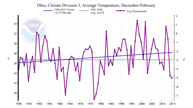
13) We forget that last December was above normal with no snow for only the 3rd time in 140 years.  Christmas week in 2014 was the 8th warmest on record in northern Ohio.

14) This warmth is driven by BOTH El Nino and a strong Polar Vortex not just El Nino. Remember the Polar Vortex from last winter?  Yes, it's real (LINK)

15) Storm systems like what we are seeing currently which develop over Texas and move northeast--termed "Panhandle Hooks"--are more common in El Ninos.  Wet snows are more common from Texas through the mid-Atlantic in these years.

16) Contrary to what we believe, you cannot use one or two days or a weeks worth of weather as a predictor or the season ahead. In other words, a warm or cold December is not an indicator of the spring or summer ahead. The drivers of winter aren't necessarily the drivers of spring and summer.  It's not an apples to apples comparison.  (Remember December 2014 was warmer than normal.  Then the bottom fell out: January through February was the 6th coldest on record, coldest since 1978)

17) The fact that I have said over the last week that colder air in January will replace the relative warmth in December doesn't mean the entire winter will be colder than average. (see FOX 8 outlook issued in October)

18) Lake Erie water temperature is 45 degrees. It's been this warm before on the 22nd of December: 2001 and 1998 for starters.  The water temperature is taken at a depth of 30 feet. No one seems to have an answer as to why.

19) There is a TON of science behind seasonal outlooks. The Farmers' Almanac is not science (although I enjoy reading it).  Weather consulting companies issue seasonal outlooks tailored for their clients. This sector has grown significantly in recent years.

20) Many readers will ignore everything I typed here and replace it with their own conclusions regardless of their validity.

I reserve the right to add to this list.

I hope this helps.


Wednesday, December 09, 2015

Warmth Continues...When Will It Flip To Winter?

No one is complaining about the above normal temperatures after the two past harsh winters. Above normal temperatures across the eastern 1/2 of the US.  This warmth is not unexpected given the strong El Nino reaching peak strength though I am somewhat surprised that the warmth has been this consistent.


It can't last forever.  So when will it flip or at least trend colder with higher chances of snow!

Remember our preliminary December outlook issued back in early September showed the core of the high pressure/warmth across the northern states into Canada with the core of the low pressure centers across the south (panhandle low type systems).
Through the first week or so, the core of each HIGH and LOW is much stronger than anticipated yet they are roughly in the same position as our forecast 3 months ago indicated. However, the southern lows (Panhandle type) are far weaker and, as of this writing--December 8th--are just now showing signs of developing. (see the smaller "Ls").
Since November, the warmth has been extensive with below normal temperatures in the west. Warmer colors indicate above normal temperatures, cooler colors below normal temperatures.


Some computer model projections have been bullish in tracking these southern lows further east and the warm ridge further north into Canada by the beginning of Christmas week.


The big questions for the end of the month and Christmas week: 1) How fast will the ridge lift north and 2) how strong will the low in the southwest/panhandle region push east?

We do know this: Any easterly migration of the southwest low along the southern jet stream will increase our chances of a wet panhandle-type snow by month's end. 


The chances we will receive wet snow from a panhandle low will climb further after the first of the year. 


Friday, December 04, 2015

The Difference Between Meteorological and Astronomical Winter


"Sorry but it's still fall NOT winter!"

We get tons of notes from viewers like this each year after we tell everyone that meteorological winter just began on the first of December.

So what is the difference between Meteorological Winter and Astronomical Winter, the one that starts around December 21st?  NOAA--National Oceanic Atmospheric Administration--has a great explanation:

...The astronomical seasons are based on the position of the Earth in relation to the sun, whereas the meteorological seasons are based on the annual temperature cycle. The natural rotation of the Earth around the sun forms the basis for the astronomical calendar, in which seasons are defined by two solstices and two equinoxes. Both the solstices and equinoxes are determined based on the Earth’s tilt and the sun’s alignment over the equator. The solstices mark the times when the sun’s annual path is farthest, north or south, from the Earth’s equator. The equinoxes mark the times when the sun passes directly above the equator. In the Northern Hemisphere, the summer solstice falls on or around June 21, the winter solstice on or around December 22...


Because the Earth actually travels around the sun in 365.24 days, an extra day is needed every fourth year, creating what we know as Leap Year. This also causes the exact date of the solstices and equinoxes to vary. Additionally, the elliptical shape of the Earth’s orbit around the sun causes the lengths of the astronomical seasons to vary between 89 and 93 days. These variations in season length and season start would make it very difficult to consistently compare climatological statistics for a particular season from one year to the next. Thus, the meteorological seasons were born.
Meteorologists and climatologists break the seasons down into groupings of three months based on the annual temperature cycle as well as our calendar. We generally think of winter as the coldest time of the year and summer as the warmest time of the year, with spring and fall being the transition seasons, and that is what the meteorological seasons are based on. Meteorological spring includes March, April, and May; meteorological summer includes June, July, and August; meteorological fall includes September, October, and November; and meteorological winter includes December, January, and February. These seasons were created for meteorological observing and forecasting purposes, and they are more closely tied to our monthly civil calendar than the astronomical seasons are. The length of the seasons is also more consistent for the meteorological seasons, ranging from 90 days for winter of a non-leap year to 92 days for spring and summer. By following the civil calendar and having less variation in season length and season start, it becomes much easier to calculate seasonal statistics from the monthly statistics, both of which are very useful for agriculture, commerce, and a variety of other purposes.

You can read the entire explanation HERE  (courtesy: NOAA)

Thursday, December 03, 2015

Does Our Early Winter Warmth Mean An Above Normal January & February?

JEFFERSON, OHIO
Someone today mentioned that it had been a LONG TIME since we had such a mild late fall/early December in northern Ohio. So I checked the temperatures to see if this was true.  Sure enough. He was right.

WARMEST YEARS - NOVEMBER 1 to DECEMBER 7

1st    2001              
2nd   1931  
3rd    2015 (thru December 3rd)
4th    1994   
5th    1982 
6th    1998 
7th    2011 
8th    1902 
9th    1948 
10th  1909

That's great but what are the January-February periods like in these years? The final numbers are below:

  • ALL BUT ONE WAS SIGNIFICANTLY ABOVE NORMAL


  • 4 OF THE TOP 10 YEARS STAYED IN THE TOP 10 IN JANUARY AND FEBRUARY


WARMEST YEARS        JANUARY-FEBRUARY 
NOV 1 to DEC 7            TEMPERATURE RANKS  (DEPARTURE - 30 YR RUNNING AVG)

1st    2001                9th warmest            +6.4    
2nd   1931              1st warmest          +10.5  
3rd    2015              ???
4th    1994              64th warmest          +2.1   
5th    1982                19th warmest          +6.2
6th    1998              34th warmest          +3.5 
7th    2011              10th warmest          +4.7 
8th    1902              81st warmest          +0.1  
9th    1948              8th warmest            +5.8  
10th  1909              102nd warmest       -1.0  


Unless something changes significantly, our winter outlook which featured near or slightly above normal temperatures with slightly below average snowfall should hold up.


Tuesday, November 24, 2015

How Much El Nino Warm Water Is Out There?

Often times, weather maps are hard to conceptualize unless you use them everyday. Since the summer, my El Nino posts have been filled with colorful maps analyzing ocean water temperatures, air pressure, possible winter storm tracks and air temperature. These maps are pretty basic for meteorologists and atmospheric scientists who view these everyday. For the non-scientific viewer, the colors can be as convoluted as a Rorschach diagram if not properly put into perspective.

Below is a picture of the Pacific Ocean temperatures relative to average.  Warmer and cooler pockets are easily visible. The El Nino is the band of warmer colors in the middle along the equator.

Just how large is this area of warmth?  How much water are we talking about?

Consider that the length of Lake Erie is approximately 240 miles. The distance across the main ENSO region in the yellow box below where the core of the warmth is located is roughly 5000 miles. The depth of this warmth is roughly 100 meters or slightly more than 300 feet.


The area boxed in yellow is roughly equivalent to 75% of the contiguous United States.

Performing a quick volume calculation (area times depth), we come up a HUGE volume of relative warm water in the El Nino region using these parameters: 


The VOLUME water in the equatorial Pacific Ocean where water temps are running at least 3 degrees Celsius (~5 deg Fahrenheit) above normal is more than 25 TIMES GREATER than volume of ALL the Great Lakes! WOW!


Monday, November 16, 2015

Do Warm Novembers Lead To Warm Decembers?

Our November forecast was for above normal temperatures.  Through the 16th (eventually through the 18th) it will verify quite nicely.  But do these warm temperatures across much of the US mean that december will be warmer than normal?  Not necessarily. I found the warmest FIRST HALF NOVEMBERS in northern Ohio and charted below the Decembers that followed.

Notice that each December is a bit different.


The bottom line is you cannot use a few weeks in early November as the only predictor of the month or winter ahead. 

Look what happened last winter. Each box shows the temperature across the country for each month left to right starting in November and ending in February.  I guarantee that most people were thinking these thoughts after each month:


Tuesday, November 10, 2015

I Need Your Input/Ideas


It's been almost 10 years since I started my weather blog SCOTT'S WORLD OF WEATHER. Back in late 2005, it was a more general blog about my observations of the world as a new father coupled with some random science and weather. About 5 years into it, my focus shifted to the technical side of weather, atmospheric science, forecasting and our perceptions/biases of both. It slowly became a diary of my thoughts about these technical subjects which, by their nature can, and have become self-indulgent to a certain degree. The last thing I want is to be so far drawn into a subject technically that the narrative I'm trying to convey becomes thickly bloated with esoteric terms and convoluted analysis. The last thing I want to do is lose people.

As a result, I believe many posts have lost sight of what the reader really wants.  So I'm asking everyone who reads my blog what they would like me to cover and how they would like it done. Let me know what you like, what you don't. Let me know what was too hard to understand.  Please let me know in the comment section below. Do you want more explanations,less explanations? Pictures? While I can't promise that each blog post will be clean and simplified for every one's taste (after all, the world of science is a very complex place), I will work on explaining each element a bit better.

Send me your comments at the bottom of this page or at the following locations:

Via email:  scott.sabol@fox8.com
Facebook:  http://facebook.com/scottsabolfanpage
Twitter:  scottsabolfox8
Instagram:  scottsabolpics

YOUR FEEDBACK IS WELCOME.

In advance, thank you!

Tuesday, October 27, 2015

El Nino Update: 1997 vs 2015

I plotted the weekly sea surface temperature anomalies starting in early June for the ENSO 1.2 region (closest to the South American coastline).


 Notice how 2015 is running cooler versus the 1997 event. Another component into our winter weather outlook which airs this Thursday at 6PM on FOX8!


Thursday, October 22, 2015

Winter Temperature Trends in Ohio (Midwest)


The National Climate Data Center has a great site for graphing the many climate divisions and climate regions across the U.S. So I plotted the winter (December through February) average temperature trends for various regions around northern Ohio since 1940. I chose 1940 because prior to the late 1930s, the official NWS temperature reading was taken at various locations throughout the Cleveland area. Since 1940, Hopkins Airport has served as the official NWS temperature location.

Notice the very cold winters of the early 1960s, late 1970s, highly variable winters of the 1990s and early 2000s and the last two cold winters at the far right side of the graph.

Overall, the trends are similar with each graph showing winter temperatures more consistently above average since the early 1980s. The overall warming trend however amounts to a tenth to a few tenths of a degree per decade in Cleveland and surrounding climate divisions and outside regions.

Note: My only aim is to show the past winter temperatures (December through February) with NCDC data. Nothing more. Nothing less.

ENTIRE STATE OF OHIO


 Ohio climate divisions:


NORTHEAST OHIO
NORTH CENTRAL OHIO
 
MANSFIELD, ASHLAND REGION


CORNBELT


OHIO VALLEY: OH, IN, IL, MO, KY, TN, WV