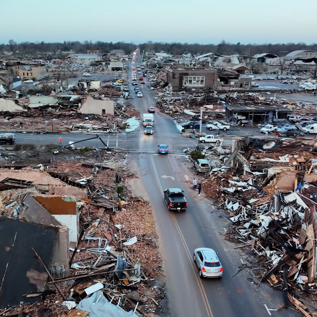
The clean up continues across the south after Saturday's deadly tornado outbreak.
people lost their lives as 71 tornadoes hit after dark between December 10 and 11 across parts of 4 states. This LINK HERE lists multiple resources on the damage assessments.
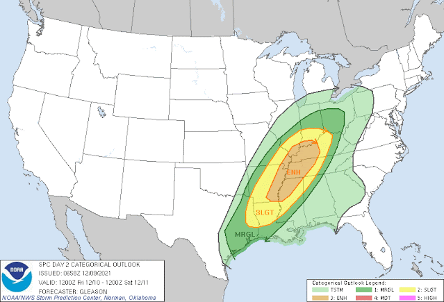
More than 48 hours prior to the event, the Storm Prediction Center started to plant the seeds of potential severe weather.
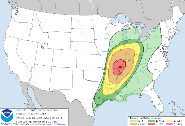
By Friday, the SPC narrowed and upgraded their outlook from Enhanced to Moderate:
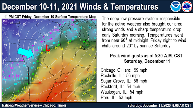
Chicago NWS graphic below shows the HUGE differences in temperature.
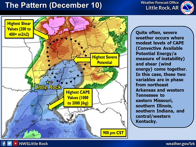
The severe storm parameters were present. Graph from NWS Little Rock, AR.
Storms were building in the distance. Notice the sunshine ahead of the storms. This can create a false sense of security.
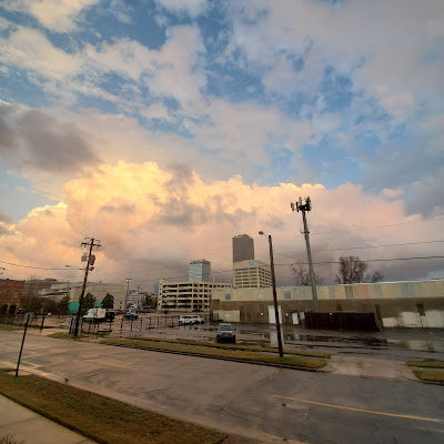 |
| Nathan Scott, Little Rock, AR |
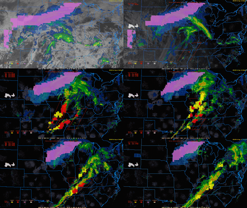
Look at the wide variation in weather occurring simultaneously on December 10-11. Winter weather watches across the upper midwest. Rapidly deteriorating conditions in the south as the line of severe storms tracked east. Notice the tornado watches/warnings in red.
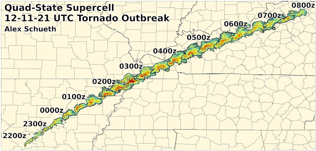
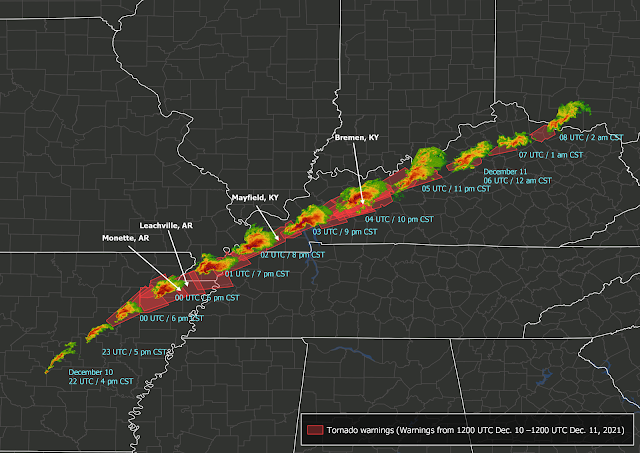
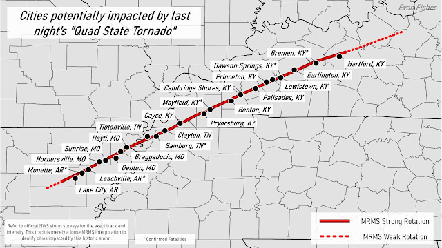
This line which evolved into two separate lines produced large scale damage from western Ohio to southern Arkansas.
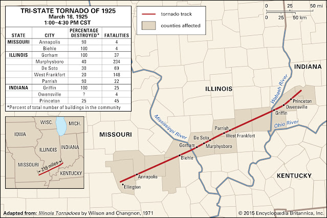
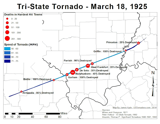
Total path exceeded 200 miles
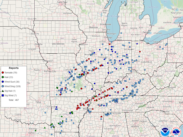
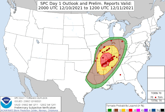
Meteorologists at the SPC and the various other NWS offices across the central US did an amazing job in giving advanced warning. Look at the accuracy of the outlook vs the tornado reports.
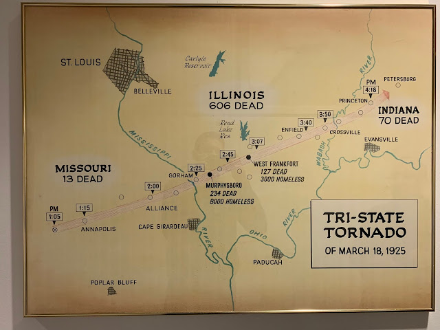
This outbreak could end up breaking the tornado track record set back in 1925
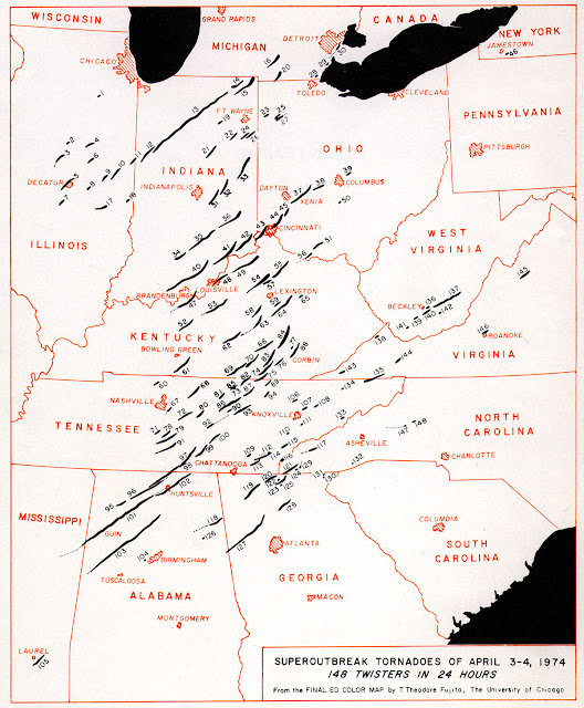
For perspective, here is a map of the tornado outbreak in April 1974
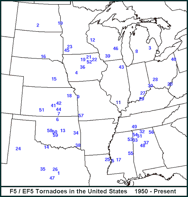
More details will be forthcoming on the strength of the tornadoes. Here is the list and locations of ALL EF4 & EF5 tornadoes. The last EF5 was May 2013.

No comments:
Post a Comment