For several years, I've been implementing a variety of research in creating long range outlooks for the Ohio Valley and Great Lakes on the 18-21 days time scale. In fact last year, almost a year to the day, I issued a long range December outlook using the same techniques highlighting a panhandle snow track on the 8th (Outlook was dead on. The percentage was too low) CLICK HERE FOR THE POST
One of the variables I use is daily changes in the Southern Oscillation Index (SOI).
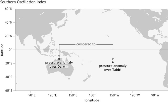
The SOI is the different in pressure between Darwin, Australia and Tahiti.
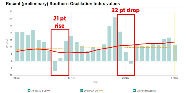
Look at the daily SOI values since early November. Notice the period where the SOI rose near 20 points over a 2 day period and a drop of more than 20 points. First period was Nov 15-17, the second was Nov 14-16.
The sharper the change (rise or drop) the greater the effects in other parts of the world. Meteorologist Joe Renken was instrumental in doing the research showing what these changes mean 2-3 weeks days in the future across North America in different seasons and different ENSO states (El Nino, Nada or La Nina). You can read the paper HERE.
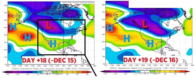
The first sharp SOI rises above yielded these upper level composites in similar seasons/conditions. Notice the ridge in the central US and the lingering Great Lakes/Eastern US low pressure. I posted this a week before Thanksgiving. The seeds were for the December warmth were planted here.
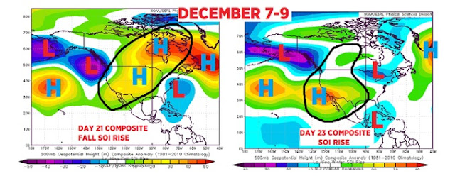 |
| SOI composite: Day 21 & 23 ahead |
The SOI drop (right red box above) gave us these composites.
You can see the high pressure/warmth across the southern states. What's also apparent is the lingering low pressure from the British Columbia coast east along the US/Canadian border and into the Great Lakes. A big indicator that Clipper Systems and short-lived intrusions of cold will interrupt the warmth. We have already seen this up & down pattern in reality thus far since Thanksgiving. Remember that this pattern was indicated in late November.
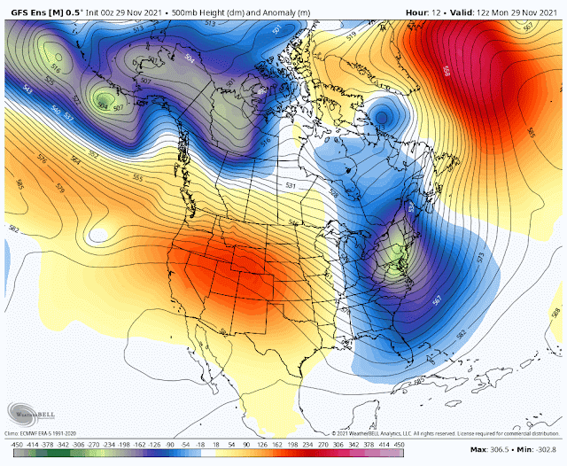
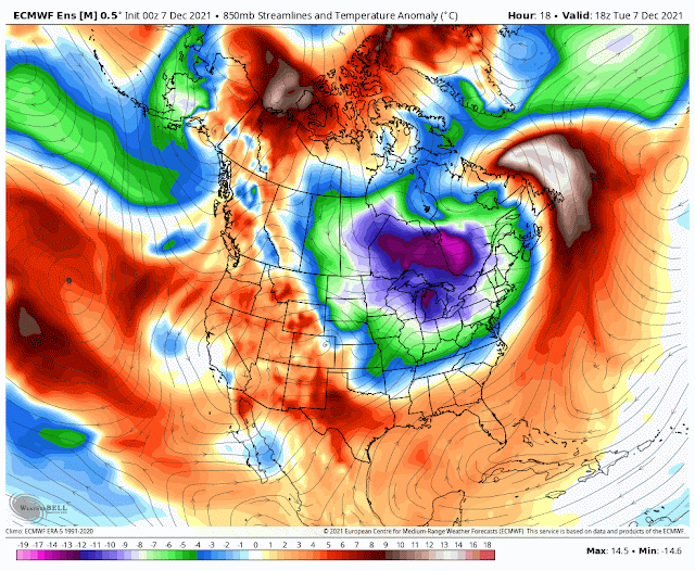
The actual computer model output (GFS) on November 29 mirrored the composites!
So what did all of this SOI analysis before Thanksgiving tell us about the mid-December outlook? It tells us that above normal temperatures were coming. We'd have brief interruptions of cold with local snow from time to time before the longer lasting period of "warmth" around the middle of the month. As of this writing (December 7) I still think we will see a 60 with sun BEFORE Christmas week!
The current model output (December 7th) shows the warmth finally popping across the eastern US. Loop is from Dec 7 to December 22.
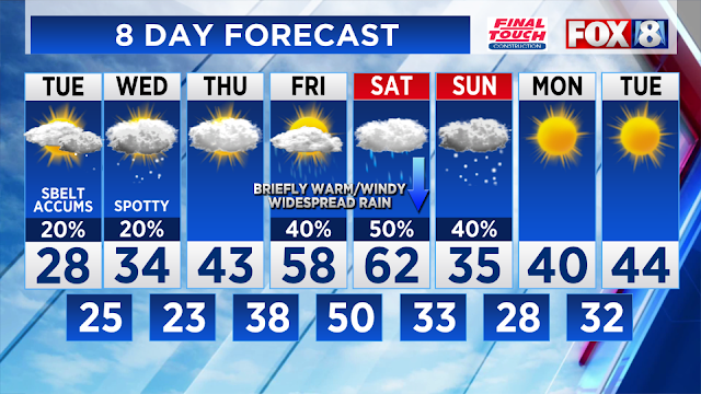
Our northern Ohio 8 day forecast illustrates the up and downs.
Note that the SOI was only one of several other variables (not mentioned here) were used in creating the mid December outlook.
Who says we can't predict the weather 20 days in advance!