Showing posts with label Arcus Clouds. Show all posts

Friday, August 12, 2016

What Are Shelf Clouds?

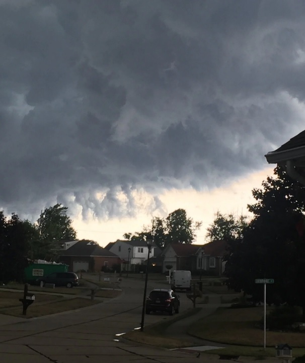
Thursday, August 11, 2016 several strong thunderstorms passed over the Cleveland suburbs. Many viewers submitted photos of stranger cloud formations with some speculating that there tornadoes. What are these clouds?  Are they a rare phenomena?  Not really. These are called shelf clouds or Arcus Clouds. They are fairly common around thunderstorms even in northern Ohio. I blogged about shelf clouds over 10 years ago!


What are shelf clouds? The National Weather Service has a great description.
Shelf clouds are typically seen at the leading edge of a thunderstorm or squall line of thunderstorms. Remember, shelf clouds are not tornadoes or wall clouds. These are formed when rain-chilled air descends in a thunderstorm's downdraft, then spreads laterally when reaching Earth's surface. Warmer, more moist air is lifted at the leading edge, or gust front, of this rain-cooled air. When this warm, moist air condenses, you see the shelf cloud. 
Normally, you will feel a burst of cooler wind followed by rain and maybe hail. The higher gusts occur on the back edge which can cause downed trees and power outages. So when the next storm develops, look for the Arcus Cloud. Remember that tornadoes normally don't accompany these cloud formations just gusty winds, rain/hail then the highest winds toward the back end.




Wednesday, July 20, 2011

June 15th to July 17th Temperatures Since 1991

We are in the midst of our first heat wave across northern Ohio.  Temperatures will stay above 90 for several days until the heat pushes back to the west late this weekend.  Is this type of heat across the country common or a rarity?  Below is a plot of temperatures compared to normal for JUNE 15th through JULY 17th for each of the last 20 years starting with this year.  Warmer colors indicate temperatures above normal.

Check out 1998 and 1994.  The heat looks very similar to what has been going on most of this summer.
Notice the core of the heat in Oklahoma and Texas

Heat last year was along the East Coast, Washington, D.C.
Two year ago, the heat was once again over Texas
Heat in 2008 was along the West Coast. Cooler in the Great Lakes
Heat in 2007 in the Pacific Northwest
2006 featured heat in the norther tier and out West
2005 heat:  Central Plains
Very little heat here
Cooler temps from Texas to New York
Heat across the northern 1/2 of the US
Heat out west in 2001
Heat in the deep south/cooler north
Heat in New england, cooler in the deep south
Look familiar? Heat across Texas and Oklahoma
Temps stayed near normal
Heat over Texas; cooler in the Great Lakes
Well below normal out west; heat in Canada
Look familar? Heat in Texas, New Mexico and in New England
In 1993, heat was located East
Temps well below normal across most of the US
Heat across the Great Lakes; cooler than normal out west

Tuesday, June 20, 2006

UNBELIEVABLE Storm Clouds

Something you don't normally see in Ohio is a "Shelf Cloud" or an Arcus Cloud. Last night, a squall line developed around 8PM and produced a fast-moving Arcus Cloud. They rarely produce any rain themselves. Its the massive Cumulonimbus Clouds behind the Arcus Cloud that contain the rain/hail/severe weather.

Arcus Cloud - Northwest View


Arcus Cloud #2

Arcus Cloud - West View

Mammatus Cloud - After Arcus Cloud Passage