Here is our FOX 8 Summer Outlook for 2022!
Wednesday, May 11, 2022

Friday, May 06, 2022
Rainfall 2021 vs 2002: April 1 to May 5
Rainfall this spring has overall been above normal. Using NOAA MRMS radar data from the Iowa Mesonet Site here is a county by county breakdown of total rainfall over this 35 day period comparing this year to last year
Legend for each graphic below (2" to 7")

 |
| Mansfield, Ashland, Wayne, Holmes Counties |
 |
| Lake, Ashtabula Counties |
 |
| Cuyahoga County |
 |
| Erie County |
 |
| Geauga County |
 |
| Huron County |
 |
| Lorain, Medina Counties |
 |
| Summit, Portage Counties |
 |
| Stark County |
 |
| Tuscarawas County |
Wednesday, April 20, 2022
50 Cognitive Biases - These Influence How You View The Weather!


Tuesday, April 19, 2022
Snow to 80s in April. How Often Does This Happen?
Snow showers this morning. Yes, it's April 19th
 |
| Hinckley |
 |
| Twinsburg |
 |
.gif)

April snow is not that uncommon. Look at the snow history from Late March through April. These are the individual instances of snow for EACH DAY since April 3rd color coded.

Yet this week temperatures will be jumping significantly heading into the weekend. (SOI forecast from April 5th seems to be working out).
 |
| SOI Changes in early April connect with these historical weather conditions |
.gif)
All of this means we could go from accumulating snow to 80 in a little over 4 days. When was the last time this happened? LAST YEAR
I was surprised to find this has happened almost 60 times since 1950! The fastest SNOW to 80s was 19 hours in April 3-4, 2007
How about 80s to snow? Only 10 times. Most recently in 2018

Big temp swings in March and April occur with high frequency vs other months. These big changes occur in the central US more than in the Great Lakes.


Monday, February 07, 2022
John Telich: More Than A Sports Journalist
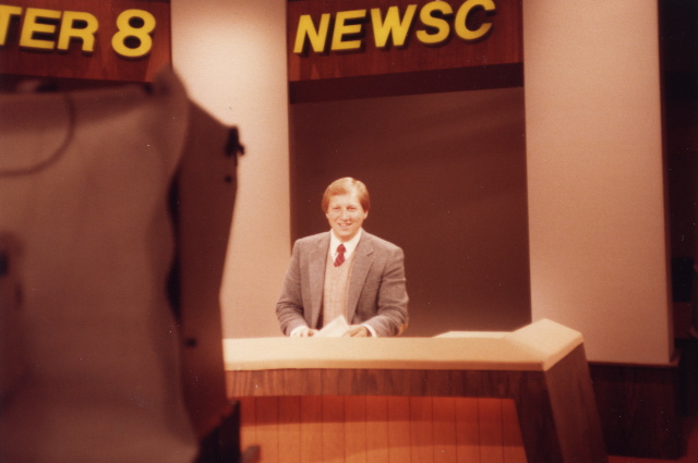 |
| John Telich 1983 |
You know him as a 45+ year sports journalist veteran here in northern Ohio. This week marks the end of the storied career of John Telich. He's covered virtually every big sporting event from the mid 1970s through the up and down 2021-22 Browns season. He tells the story when he was on the field during the Kardiac Kids 1980 season. He was on the field during Len Barker's Perfect Game. He was there when the Indians went to the World Series in the mid 1990s, He was their when the Browns came back. He was their when the Cavaliers won their first Championship. I could do on and on.
Those of us who have worked with JT know him as a man of character. His "fly under the radar", low key demeanor doesn't fit the archetype television personality and that fits him just fine. You might have noticed his tireless work helping others. He's the first one to arrive and the last one to leave EVERY time we ask for supplies or gifts for people in need. He takes pride in his work both on and off camera. He is a man of character.
In this social media, Tiktok-ified era we live in where many live for the spotlight, act with false modesty looking for some payout through their "15 minutes of fame", JT is a shining example of someone who goes about this day without fanfare. He handles himself with grace and humility. He conducts himself not for attention, not for clicks but for the benefit of others. Rather than gossip on the day's events, he chooses the high road and builds people up! He chooses to celebrate others.
Today we celebrate his 45+ year career as a sports journalist. JT on behalf of my family, we wish you all the joy in the world enjoying life outside of television. I'm sure we will find you running trails, reading and most of all, helping others! We should all use his work ethic and humble attitude as a template on how to act and behave each day not only in the workplace but in life.
Send him a congratulatory note. He'd love to here from you!
Tuesday, January 18, 2022
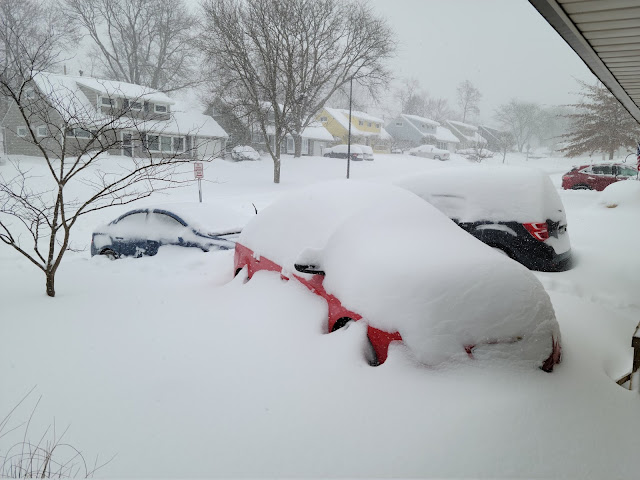
Winter Snowstorm Recap MLK 2022 - Chapter 3 of 3 (Mindset Behind Snowfall Forecasts)
So what happened? Why did the snowfall amounts trend higher?
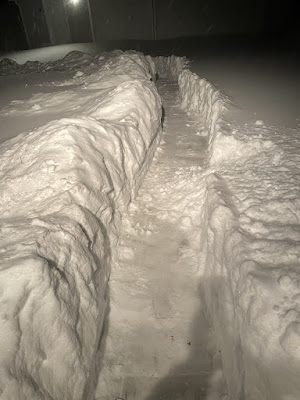
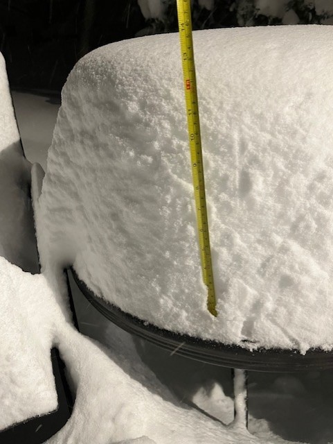
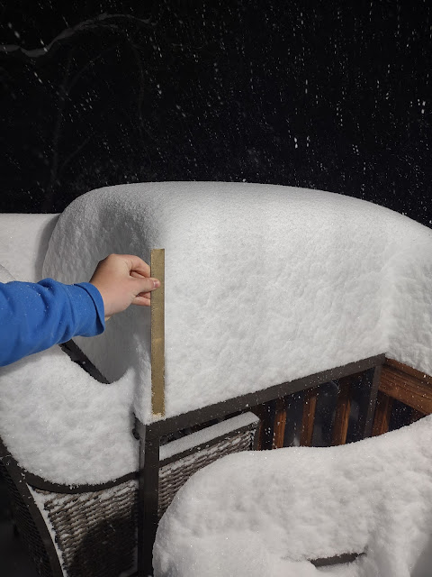
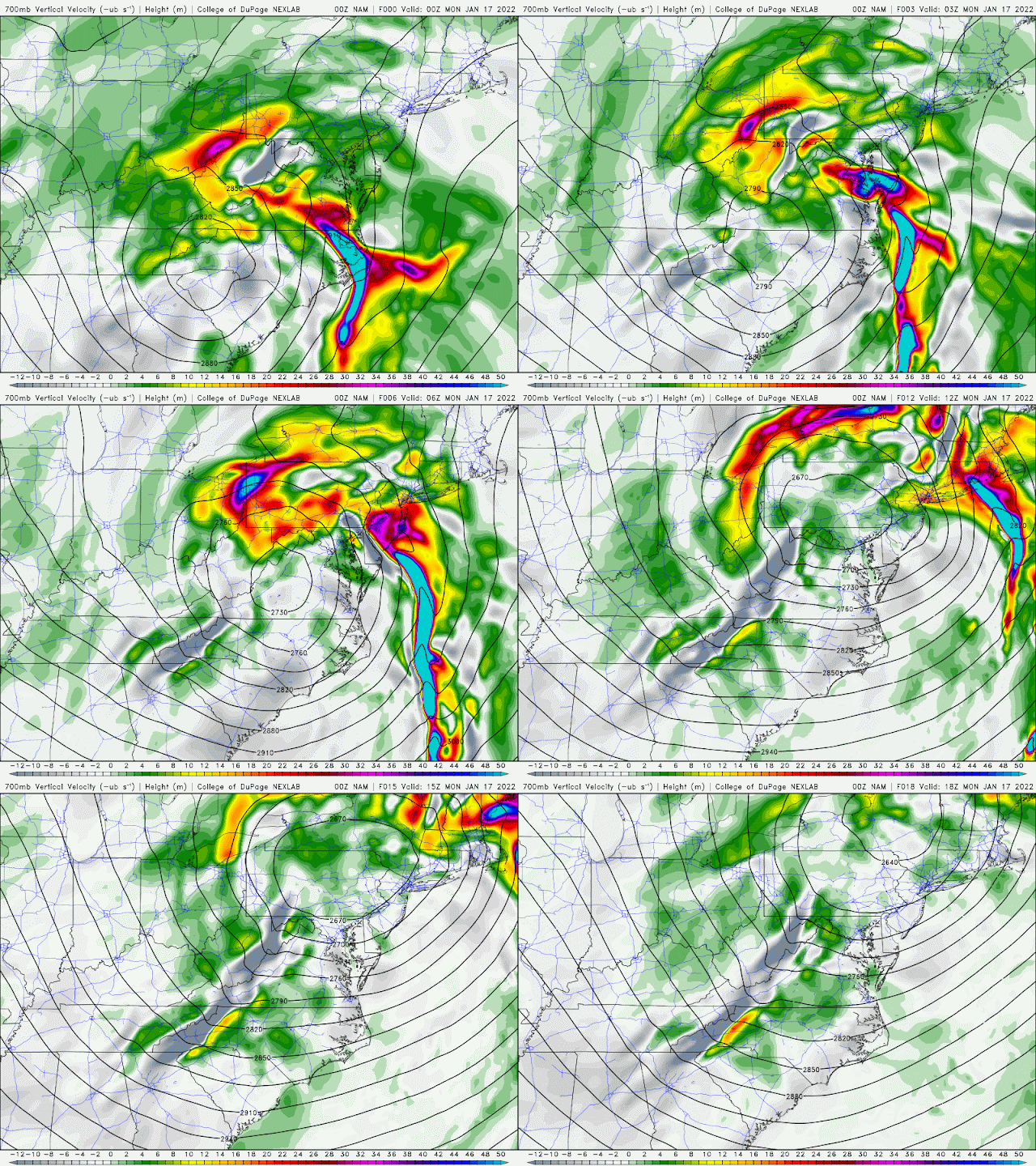
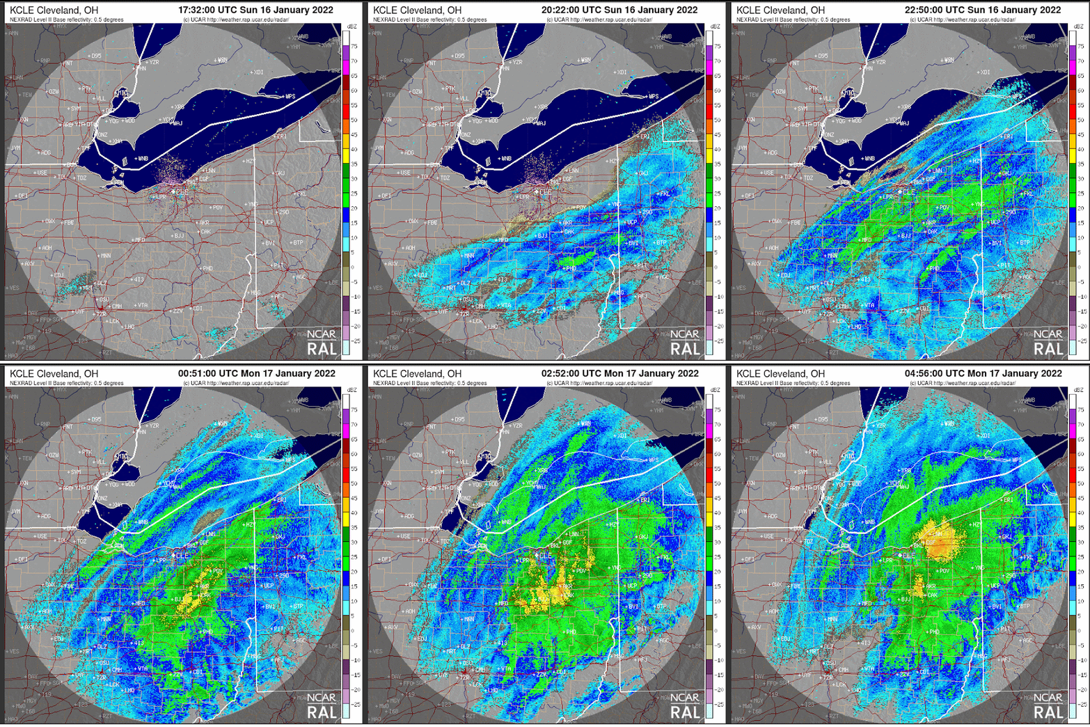
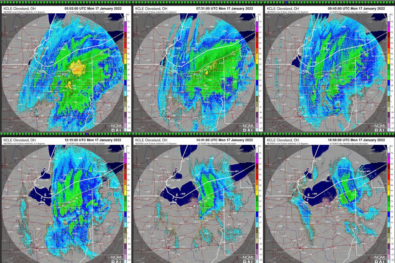
Late Sunday evening model started to show rapidly rising air (10,000 feet) on the northwestern quadrant of the parent low Sunday night/early Monday: The warmer colors along the Ohio/PA line was the catalyst for the heavier snow burst overnight. Watch the warmer colors spinning around low. This greatly contributed to the 4-5 hour window of snowfall rates of 1-2" per hour!
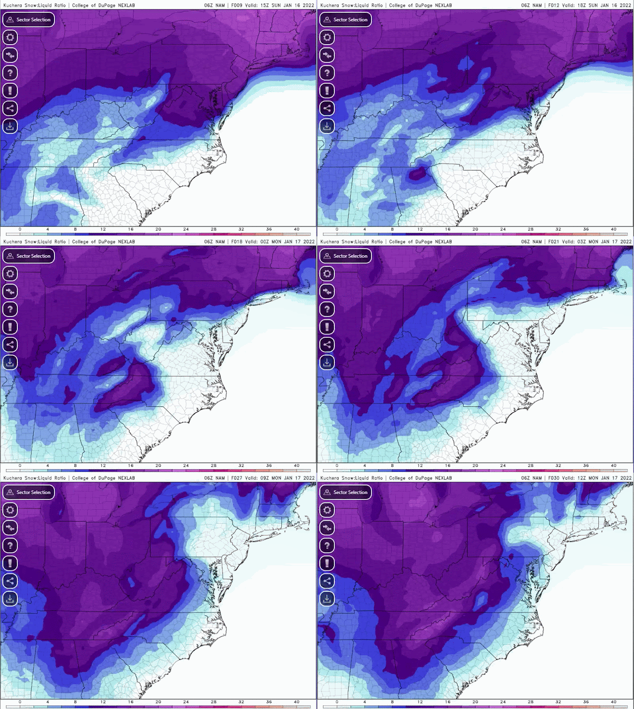
Snowfall ratios changed throughout the event. The traditional snowfall ratio of 1 inch or water to 10 inches of snowfall doesn't always work. Sunday evening/night/Monday morning, the ratio went from 6-8:1 Sunday evening/early overnight to 10-12:1 Sunday late night/early Monday morning then 12-15:1 Monday morning. Snow type went from wet snow/sleet to heavier snow then fluffy snowfall.
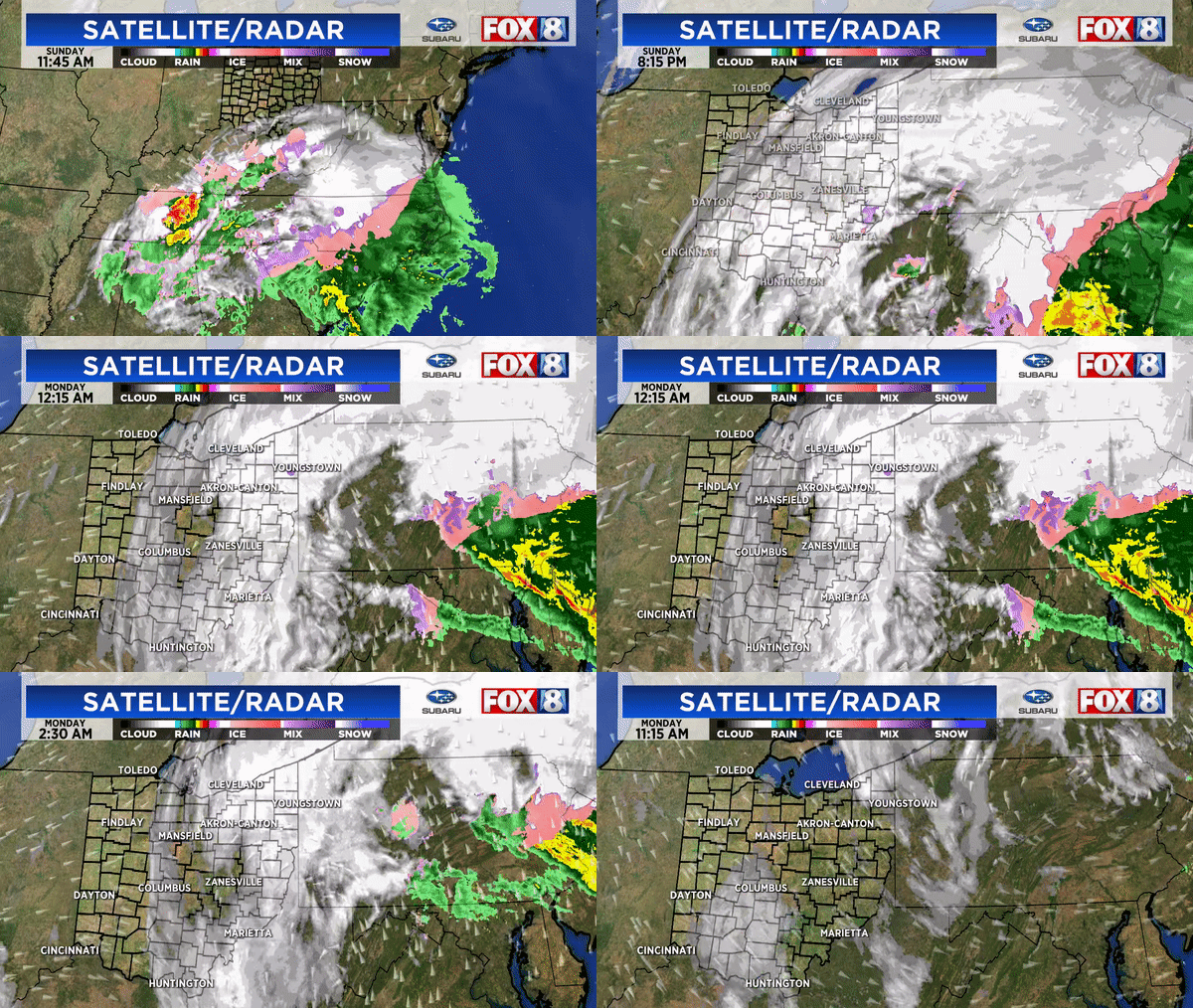
Base reflectivity radar loop from late Sunday afternoon to midnight Monday January 17
Base reflectivity radar loop from midnight to noon Monday January 17
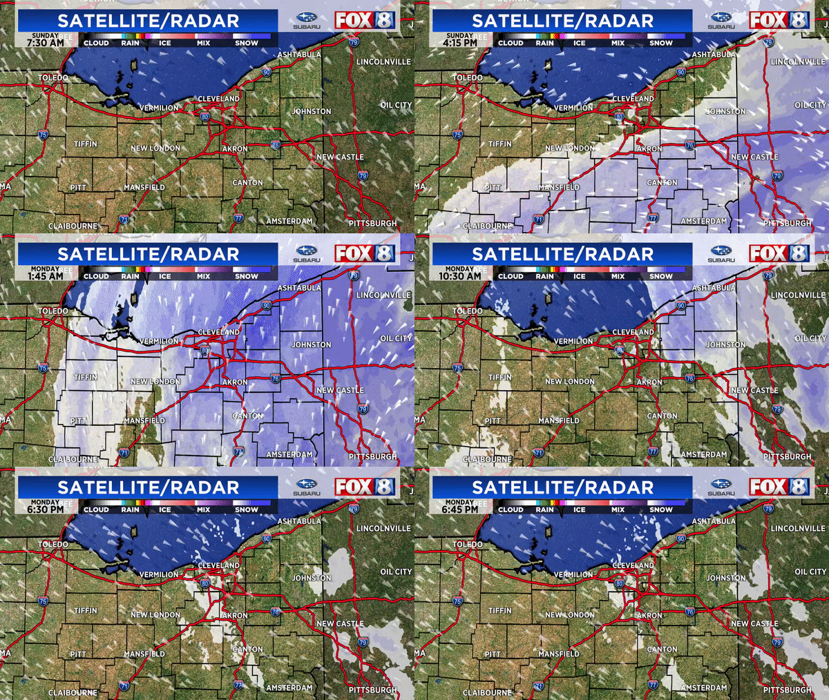
Composite local radar from early Sunday through Monday afternoon:
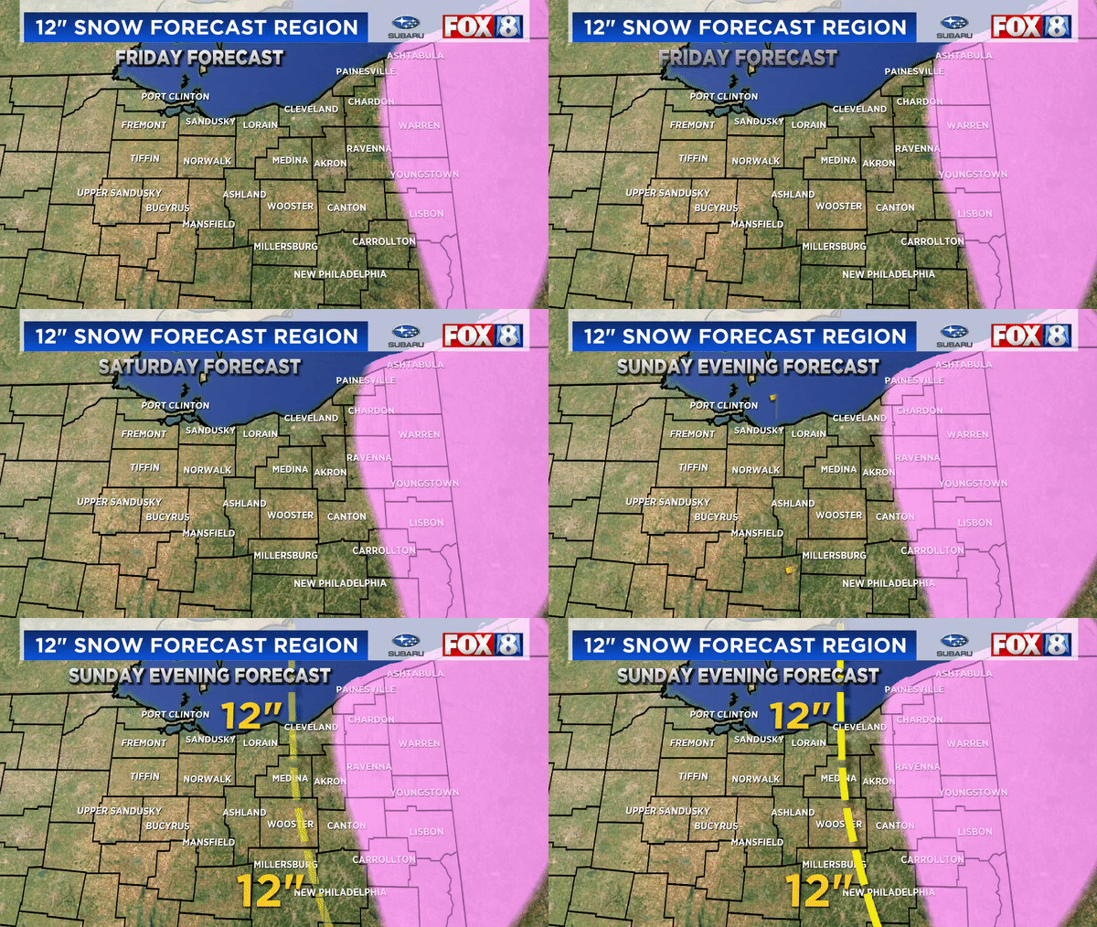
Again, our 12 inch snowfall forecast cut-off was shifted west slowly each day. The actual 12" amounts verified west by about 20 miles west of our final forecast
Overall snowfall totals from Friday through Monday. (some numbers might be too low as this is a compiled map from previous reports)


After every big weather event, its easy to Monday morning quarterback snowfall forecasts. I do it too. After forecast snow events for more than 25 years, I've seen computer models blow up snowfall amounts (once more than 35" across half of the state) only to back off at the last minute. I've been burned when trusting models verbatim many times. So here are some pointers for everyone and future forecasters:
* Models are only ONE forecasting tool not Gospel. Don't use model trends verbatim.
* Weather forecasting has and will always have a human element
* Using a blend of models or a trend model forecast doesn't mean the forecast will be more accurate
* Use history as a guide but not the only guide
* Take into account how the public will perceive your forecast knowing you'll need to augment it
How about some common questions and comments:
QUESTION: "So why didn't up the snowfall forecast to reflect the changes in the models?"
ANSWER: As said earlier, forecasts are not made solely by model output. Should more adjustments have been made toward high amounts further west? In retrospect perhaps. Some changes were made Sunday evening. Remember that this rarely happens here. SEE MY POST HERE
STATEMENT: "Models predict snowfall. Models predict rainfall. This seems easy."
RESPONSE: Hardly. Models don't forecast snowfall specifically, they forecast liquid precipitation then translate it to snowfall using a ratio (often times 10 to 1 but not always). All snow events are not a continuous 10:1 or ratio. The ratio changes over time. The trick is determining what the ratio is and how long/intense the snow.
COMMENT: "We weren't under a winter weather advisory on Saturday yet we got 5-10" of snow Monday. We weren't prepared for this!"
RESPONSE: I disagree. The seeds of this stormy pattern were showing up around Christmas. We started mentioning the high potential for snowfall 5-6 days before the event. Initial snowfall forecasts were made early Saturday. Adjustments were made Sunday morning as advisories then warnings were issued for western counties"
COMMENT: "I had 5 inches of snow in my backyard yet my county was under a warning. Wasn't that overkill?"
RESPONSE: Back on Friday we mentioned that their would be a sharp cutoff west to east between super heavy snow and less amounts due to the position of the storm. Eastern half of many counties received 12"+ while the western parts received half of these numbers. Advisories and warnings are issued on a county basis knowing that local snowfall amounts will vary over short distances.
REMEMBER: Weather doesn't stop for county lines.
COMMENT: "I saw the storm strengthening in Virginia. You should have predicted more snow."
RESPONSE: "Strengthening storm systems hundreds of miles away DOES NOT necessarily translate to more snow in northern Ohio"
QUESTION: "What have you learned from this snowstorm?"
RESPONSE: "Great question. I am studying all aspects of the storm and the conditions that were present in an effort to better forecast the next one. I've also realized that people will react to snowfall forecasts differently depending on how they experience the snow (psychology and perceptions). As communicators of weather information especially snow, we're damned if you do; damned if you don't."
"Snowfall forecasting especially with major snow storms are multifaceted and highly nuanced and never made in a vacuum. Adjustments were made by ALL meteorologist both on TV and within the National Weather Service as the situation developed. If we would have posted 16-25" initially people would have said we were crying wolf if it didn't work out. I've seen it a hundred times."
Winter Snowstorm Recap MLK 2022 - Chapter 2 of 3 (Meteorology Behind It)
The seeds of this huge snowstorm were first planted around Christmas. How is possible? We started noticing signs that the HUGE ridge of high pressure in the northern Pacific was starting to move after sitting still for most of December locking in the milder pattern across the eastern US.
Watch the big red blog move northwest into eastern Siberia and north of the Arctic Circle. Low pressure centers (blue areas on the left) then could moves off of eastern Asia east undercutting the moving ridge. These lows filled the void left by the departing high pressure ridge. This animation is from December 31 to January 5.

The overall upper level pattern starting flipping in the first week of January. Look at the lows across the Canadian/US border.


On Wednesday January 12 (4-5 days before the event) the long range projections were latching onto the idea that this low in the upper mid-west was heading south through Missouri then back up along the Appalachian Mountains.

 |
| Snowfall from Wednesday January 12 through Sunday morning January 16 |
My first general snowfall outlook for significant snowfall was issued Thursday. These panhandle/eastern US snow systems historically have stayed east of northern Ohio even as computer models attempt to push them west with record setting snowfalls. I remember a long range model produce 30-35 inches of snow for half of Ohio in one instance! I was cautious to jump on the bandwagon.

What did the long range models say regarding snowfall on Wednesday, 4+ days before the snow event?
First the American Model:

Next the Canadian Model:

The European Model:

24 hours later (Late Thursday. 3+ days before the event):
There was a discernable shift in the heavy snow into Pennsylvania and along the Ohio/PA line south into the WV panhandle.


By Saturday morning, the model output showed the heaviest snow depth still along the Ohio/PA border by early Monday afternoon. I'm using weather.us model output maps here.
First the American model:

And the European:

The National Weather Service in Cleveland issued these winter weather advisories starting Saturday late afternoon.

Now Sunday morning's model output. First the longer range models (GFS and EURO) then the shorter term, higher resolution model output (NAM). Each one was showing a trend further west with the 12"+ snow amounts.
 |
| GFS |
 |
| EURO |
 |
| NAM |

The NWS continued to expand the advisory/warning areas further west Sunday evening.

The NWS snowfall forecast Sunday late afternoon/evening:


Our official FOX8 snowfall forecast issued Sunday evening. We shifted the heavier snowfall into Summit and parts of Cuyahoga Counties with the 9"+ snowfall edge near I-71.

The 12 inch snowfall forecast cut-off was shifted west slowly each day. The actual 12" amounts verified west by about 20 miles west of our final forecast

The storm prediction center highlighted heavy snow fall in their regional discussion Sunday late afternoon. Temperatures were between 25 and 30 degrees at sundown so the initial accumulations were more "sleety snow"

Subscribe to:
Posts (Atom)